Table of Contents
Why use a photography app?
The best laid landscape photography plan doesn’t always make the photoshoot successful. There are many factors that can thwart even the most meticulous of plans. The chief adversary is usually the weather. As with everything though, good planning is essential. However planning doesn’t always have to mean trying to get what you want; it can also mean planning to make the best of the situation. In this article I give you lots of useful tips on how to plan your landscape photoshoot with the best apps for photography, using examples situations of where a particular app helped me out.
Making the best of the light available
Unlike studio photographers, landscape photographers have little control over the light and conditions. We are ultimately at the mercy of Mother Nature. Thankfully though, modern technology has armed us with a vast array of apps for helping us plan and predict the best time, weather and conditions for taking perfect photos, or to evaluate the situation and decide how to make the best of it.
Use the best apps for taking photos you want
When thinking about the kind of image you plan to get on your landscape photoshoot, in the case of a sunrise or sunset you might want the right kind of cloud to light up the sky in glorious colours. Or maybe you want the sun or the moon to be in a certain position at the right time; namely rising or setting behind a particular building, mountain or other landscape feature. Maybe you want a particular scene to be lit from a certain angle.
Often when we discover a location, and more importantly a great composition, it’s rare that the light and conditions at the time of discovery are conducive to the kind of photo we have envisaged, or would make the best of the scene. In most cases we will need to re-visit this location time and time again to get the best out of it. If we live nearby then it’s easy to keep going back and forth, but for those more distant places it’s not so easy and we cannot always afford to just pop by on the off chance of favourable light; that’s where planning comes in.
A study of the scene and the orientation of the objects within it can help us to form a plan. Is this a sunrise or sunset shot, or both? At what time of year will the sun rise or set in the right place in order to cast soft, warm light upon our scene? If there is a building or some natural feature we want to emphasize, which way is it facing and what time of day or year will the best light fall upon it?
Best apps for photographers to plan their landscape photoshoots
There are many ways you can plan for taking great photos, but these days one of the best is to make use of the many great Android and iOS apps available today. Here are some of my personal favourites:
1: Clear Outside
This, in my opinion, is by far one of the best apps for photographers and is invaluable when trying to ensure the right kind of sky for your landscape photos. While primarily intended for astronomers, this app has been embraced by the photography community for good reason. It provides a wealth of information. Not only does it give you predicted cloud cover by percentage, but it also breaks it down into high, medium and low cloud. This is critical for sunrise and sunset photography because high cloud will catch the colour if there is little or no low cloud.
Also, if you want to capture the sun rising or setting over a cliff, mountain or the sea, then it needs to be clear on the horizon where the sun will crest the mountaintop. You can also enter coordinates for any part of the world, so if you are planning a view of the distant mountains then rather than look at where you are standing, you need to look at the weather over those particular mountains and far off to the horizon where the sun will be.
A plan for a sunrise photoshoot at Saint Thomas Church
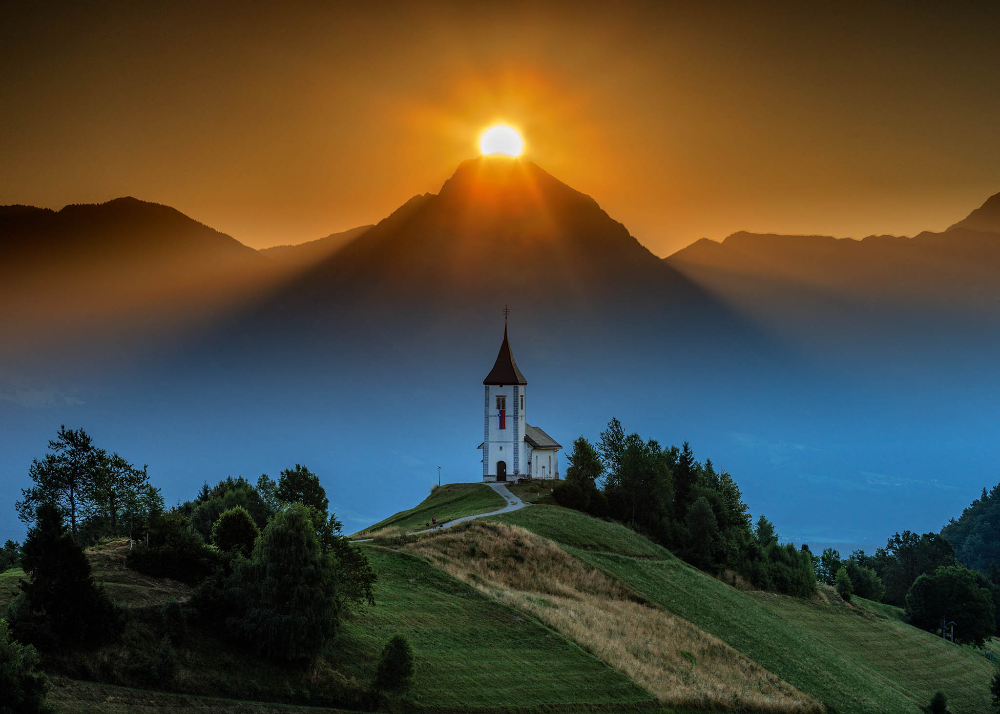
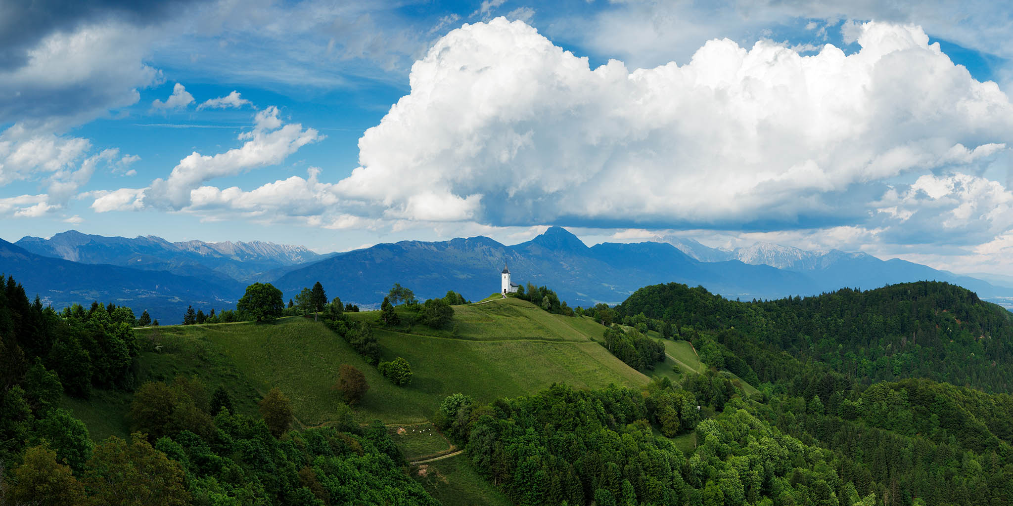
At the classic viewpoint of the church of Saint Thomas in Slovenia, the church is facing southwards, which means that in order for light to fall on the facade you need to be there in winter when the sun rises more to the south. As it moves north the church is backlit. However, I had charted its journey and worked out that when it reaches its furthest point around the week of the summer solstice it will rise over the mountain peaks behind the church, close enough to get a good composition. So I used the Clear Outside app to plan a photoshoot to capture this moment, and managed to take exactly the photo I wanted.
It took me two years to get the right conditions, each time using the Clear Outside app to choose the best times to go out. As with all weather forecasts, it’s never 100% accurate and conditions can always change. The first year my attempt was thwarted, not by too much cloud (conditions over the mountains were perfect), but a thick bank of fog that inconveniently blew in and completely obscured the scene right at the exact moment the sun peaked over the mountaintop. A year later, the app showed clear skies all round and zero chance of any mist, so I got my shot.
A Good App for Predicting Misty Mornings
Another really useful feature of this app is the dew point. If you want low lying fog in your morning scene then you typically need a clear, still and cold night. You can also look for drops in visibility. Then in the morning you can look at the temperature vs. the dew point. If the dew point is one or two degrees below the temperature and humidity is high then you stand a good chance of getting some fog or mist in the valleys.
You can use this great app on the desktop or as a smartphone or tablet app.
2: The Photographers Ephemeris (TPE)
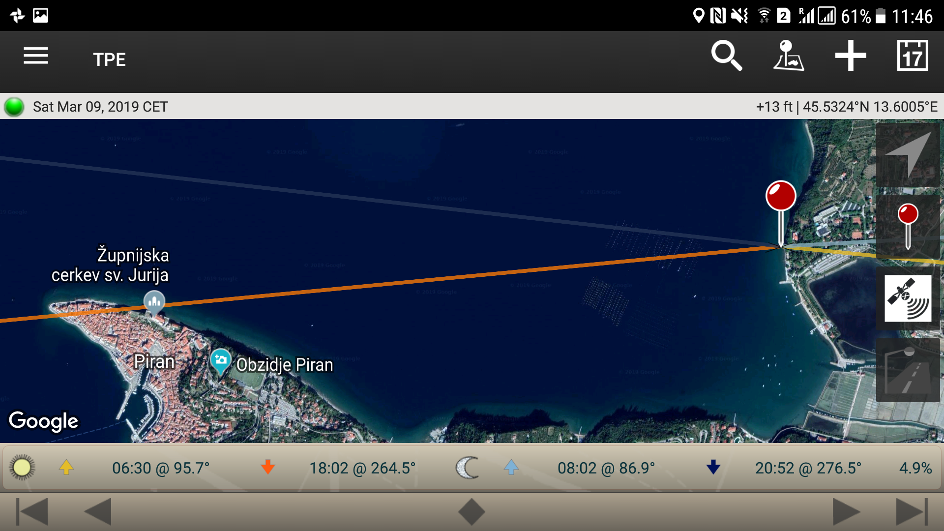
TPE is truly one of the best apps for taking photos of landscapes. This fantastic app is available as a free desktop version or a paid version on Android or IOS. Although I now use the IOS version, although a little more expensive, it is far superior. This is one of many apps that will help you make a plan for taking sunrise, sunset, moonrise or moonset photos. I use this to get a general overview of the position of the sun and moon in areas that I am close to or planning to visit anytime soon. You can simply enter a location, or browse around the map to pinpoint your subject, then scroll through dates to see where and when the sun or moon will rise and set.
When I first discovered a great viewpoint across the sea of the Church of Saint George at Piran, from nearby Strunjan, I pinpointed it on TPE, and then effortlessly scrolled through the dates to see when the sun would set behind the church from my position. I logged that date in my calendar, returned and got this shot:
3: Photopills App
The Photopills app is like TPE but offers so much more. I haven’t even begun to figure out many of the features, but its greatest feature is the ability to choose a subject in a given location and then do a search for up to five years to see if the sun or moon will rise or set behind it. If so, then it will display those dates which you can save for future plans. This is of course just one feature, and as with TPE the IOS version has many more features which are not available on Android.
Planning a photo of the moon rising behind Ljubljana Castle
With the aid of both Photopills and a great photography location website called Photohound, I was able to plan a photoshoot to capture the moment when the moon would rise right behind the clocktower of Ljubljana Castle.
The great feature of Photopills is that you can have an idea such as this, then plot the coordinates in the app to see if your idea will become a reality in the next five years. I already knew from using Photohound that you could get this great view of the castle from a certain spot in Tivoli Park. Knowing also that the view was looking southeast, I could also work out that in summer when the sun sets to northwest the full moon would rise in the south east. This is because for the moon to be full it needs to be directly opposite the sun. A full moon rising at sunset would thus rise opposite to where the sun would set. Therefore I surmised that it could rise behind the Ljubljana clocktower from this viewpoint.
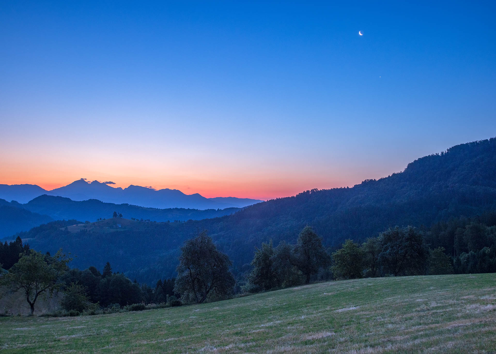
So I plotted this idea into Photopills and did a search. Voila! The 4th July was the date that came up. All I needed to do was pray for a clear sky on the southeast horizon. In this case Photopills and Clear Outside proved to be the best apps for taking these photos below:
The moon rising over the mountains behind Saint Thomas
4: Storm Radar and the Weather Channel Apps
I find the Weather Channel to be a great resource. Also the Storm Radar app that you can get through it is indispensable. You can obviously go to the website to use the Weather Channel or download the app for that, but can also download the Storm Radar app independently.
If you plan on taking photos of stormy skies, then the Storm Radar is one of the best apps when it comes to not only seeing if a storm is coming your way, but also tracking its movement and direction over a period of time. Part of the Weather Channel, this app comes as an independent app or as part of the Weather Channel app.
I use this all the time to determine first of all if it’s worth going out in bad weather but also use it to navigate around a storm to either avoid it, or get the best views of it.
Planning a photography workshop
During a private workshop I knew by the weather forecast that storms were coming, so used this app to plan the day. The participants wanted to go to Lake Bled and hike up to a well-known viewpoint called Mala Osojnica. It’s a 40-minute hike up, so the last thing we wanted was to get caught in the rain. So using this app, I could determine the movement of the storm and saw what time the storm would move in over Lake Bled and could also see the direction from which it would approach. It approached from the west, the worst of it not visible to our eyes because of the hills behind us. So I was able to watch the radar and judge the ideal time to head back down, ensuring that we got the best of the conditions and got to shelter before it hit.
Using the App for taking photos of storms
We all know how storms bring great photographic opportunities, but not when you are in the middle of it. The great thing about the Storm Radar app is the ability to track the worst parts of the storm and be able to find the ideal position from which to get the best photos.
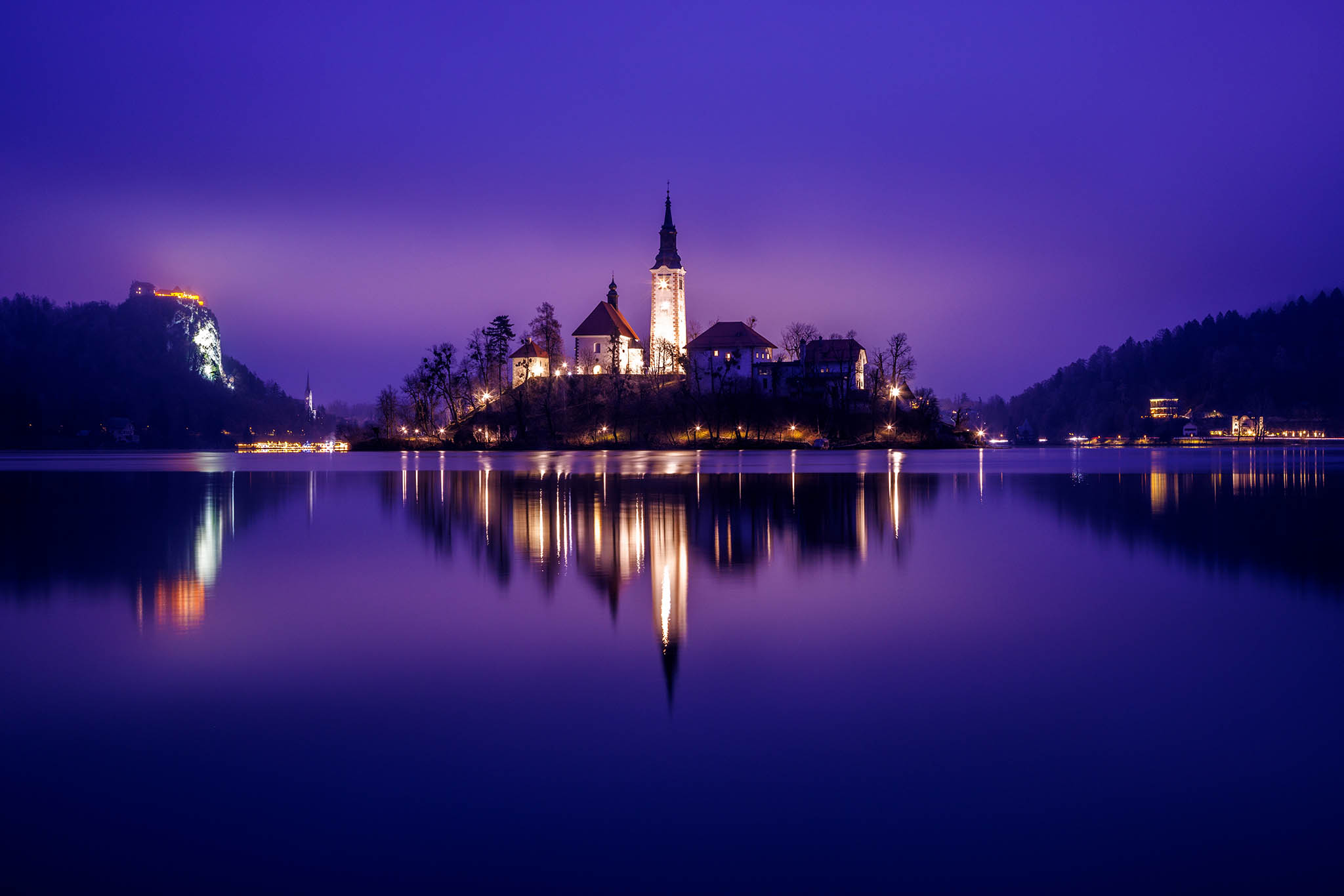
I had used the TPE app to work out the time of year when the sun would rise behind the mountains in the backdrop of the island church at Lake Bled, all seen from the other elevated viewpoint of Ojstrica. Of course once again I needed clear skies over the mountains, but the Clear Outside app showed 95% high cloud, but 0% medium and low cloud. I knew that my sunrise wouldn’t happen, but also knew that the lake and mountains would be visible. I could see by the dew point there would be no mist. So I decided it might still be worth a trip.
Capturing the storm
I got up at 4am to the sound of distant thunder. A quick check on the Storm Radar app showed the storm moving over Lake Bled in the next hour and moving off eastward close to sunrise. Although I wouldn’t get my sunrise, on account of the storm moving east, armed with this information I knew that there was a good chance of some moody clouds and light at dawn. Getting up there requires a 20-minute hike in complete darkness with a head torch, so it’s not something you want to do unless the odds are in your favour.
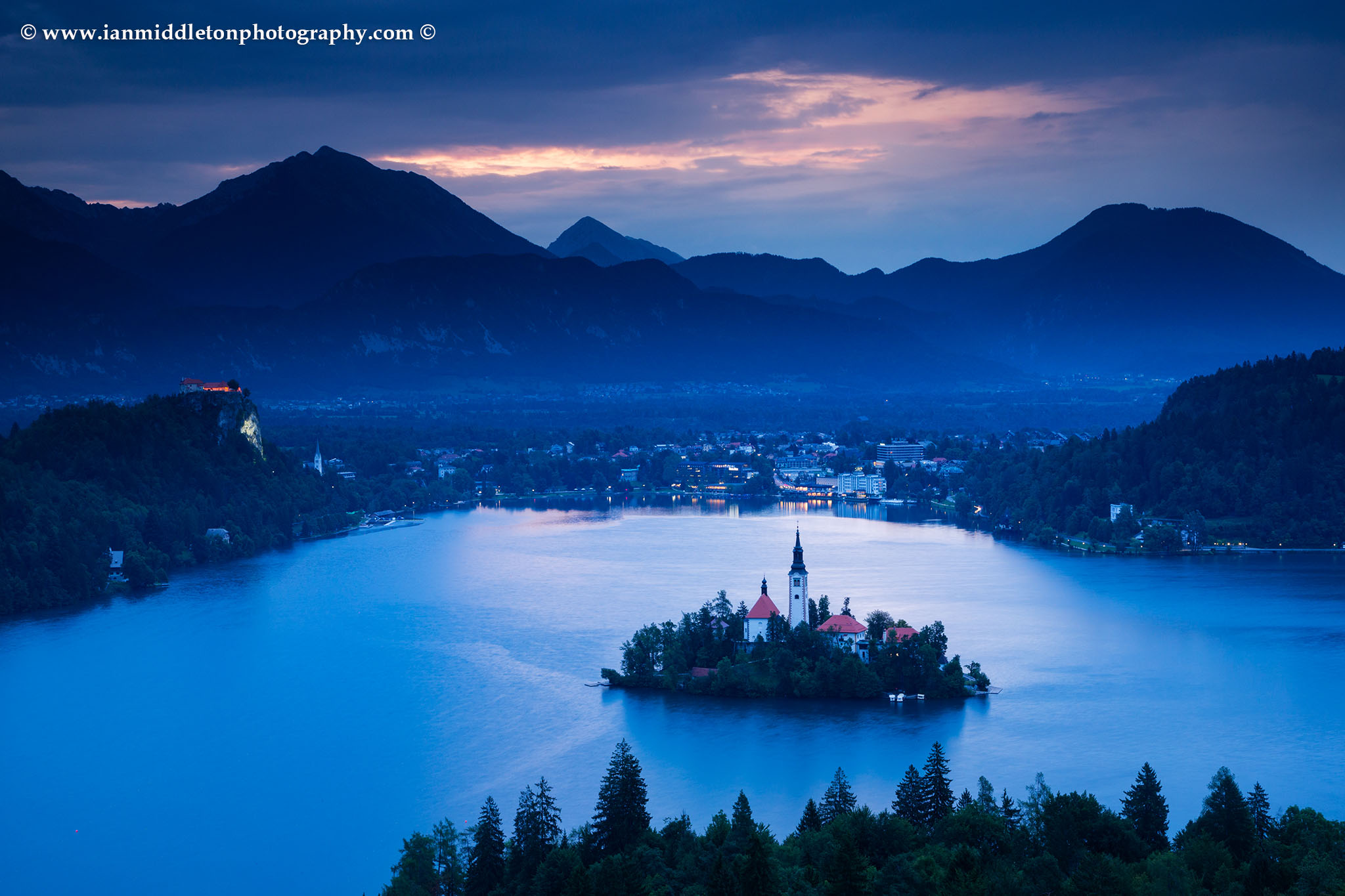
I hiked up in the rain, which had stopped by the time I got to the top, and as the storm moved away a crack in the clouds let some beautiful morning light flood out, and the lake and church (which is customarily lit, but not on this morning) got bathed in glorious warm light contrasting with the cool twilight tones. I returned with an even better photo than was originally intended.
5: Stellarium
If you are into astrophotography and plan on taking lots of night photos, then one of the best apps to get is Stellarium. There is a web based version and two apps, one basic and one pro version called Stellarium Plus. I would highly recommend getting the Plus version, which does cost but is well worth the small amount of money you have to pay.
You can use this app to plan a photoshoot of the milky way or to search for particular constellations over a certain landmark. Or, as in my case, use it to plan shoots of astronomical events such as the Neowise comet which passed us by last year. Obviously as astrophotography requires clear skies then the Clear Outside app is essential too.
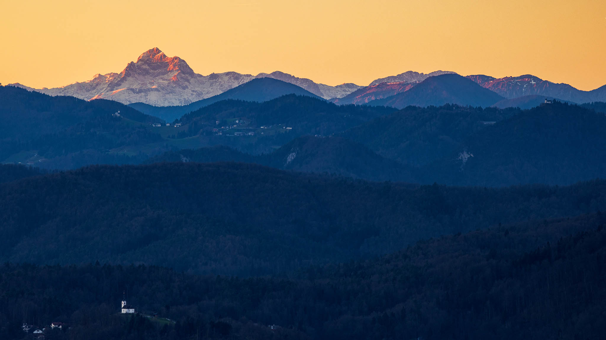
Over the three days I spent photographing Neowise these apps were essential, along with the Storm Radar app on the third day when there was a passing storm. I had found and planned a shot of Neowise over the Kamnik Alps and close to Mt Storzic. On the third night when the weather showed storms off to the north, I used Storm Radar to track it. The result was a fabulous evening photographing Neowise against lightning over the mountains as the distant storm raged over the mountain peaks.
6: Peak Finder
Find the names and heights of mountain peaks and ranges
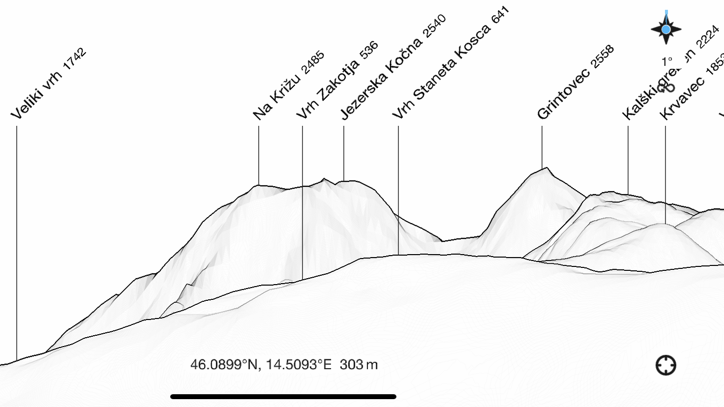
If you are someone who like photographing mountains, but often find yourself wondering: “what are the names of these peaks I am looking at? then Peak finder is the app for you. Using this app on your phone you can simply point it directly towards the mountain range you are photographing and the screen displays the name and height of each peak for the mountain range you are viewing. You can zoom in to the specific peaks for more details, a closer look and of course to ensure you match the peak on screen with the one you are photographing.
When your photoshoot goes to plan
In my opinion these are the best apps for taking photos and doing landscape photography available to us today for capturing the photos you want, or trying to get the best out of the light and conditions available. There are many factors that can thwart your plan for a photoshoot, or for a vision you have of a particular image. But modern technology, knowledge and experience can all help us to formulate a great landscape photography plan. And when that plan comes together, it’s truly the best feeling ever.
Equipment used in my photoshoots
These are links to photography equipment I use and what’s in my bag and great places to buy them.
Some are affiliate links so if you click and purchase I’ll receive a small commission in return, but at no extra cost to you.
Recent Articles
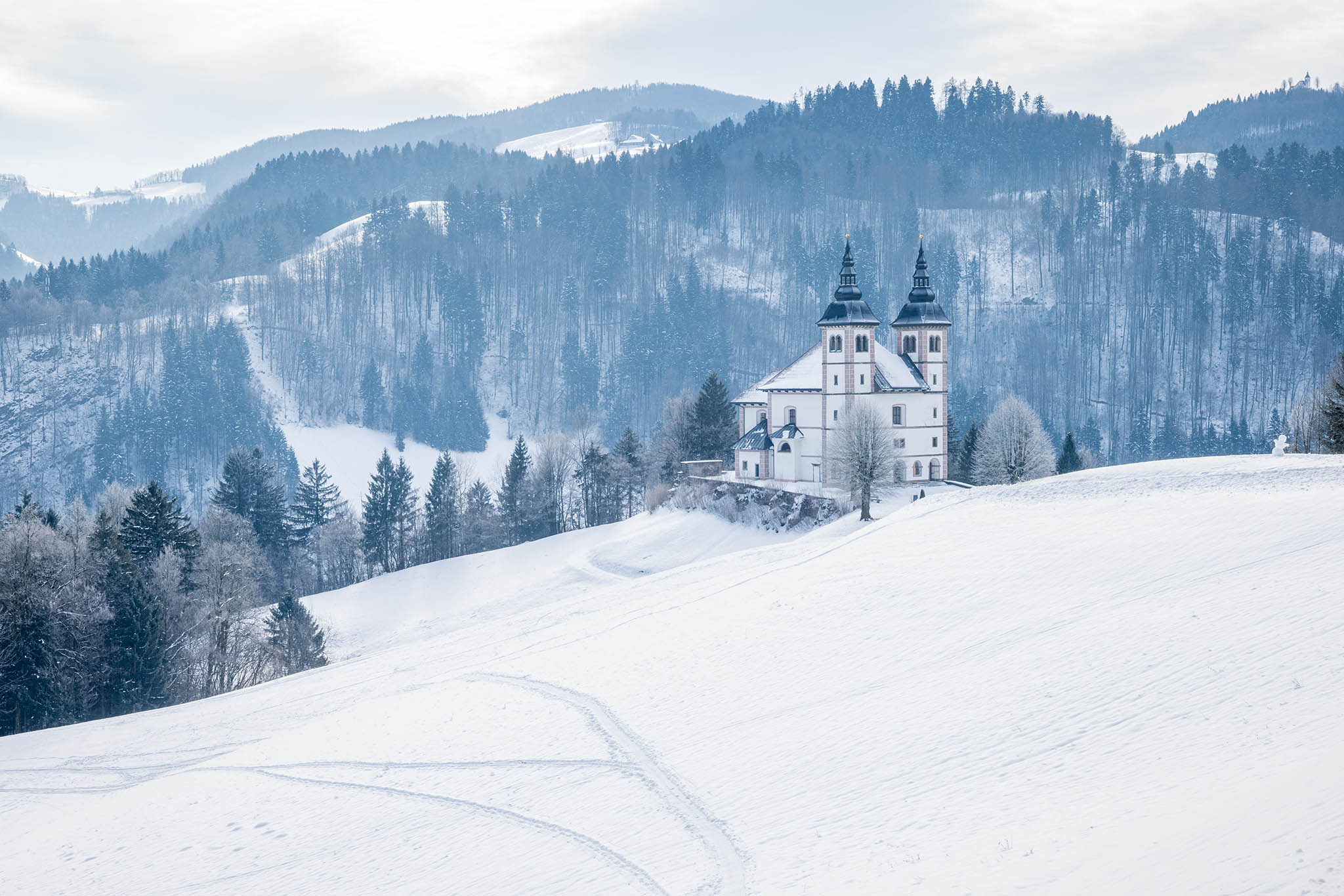
Winter Photos in Slovenia
Winter finally arrived in Slovenia the other week, albeit short-lived. So I thought I would show you some of the photos I managed to capture during that time.
My book
Learn Photography
For a more comprehensive look at photography, check out my book, available to buy at Amazon.
Shedding light on all the photography basics in one book.
Want to know how to take better photos? Well, first you need to master the basic techniques. Whether you are a complete beginner or an intermediate looking to improve your photography, this book is packed with photography techniques, tips and advice for beginners and intermediates.
All the camera functions and their effects explained.






One Response
Another great new photography app is PhotoBuddy Pro. It is a complete photography app with over 25 photography tools. It is useful for photography enthusiasts of all levels. PhotoBuddypro.com